
Planetary Mapping with NASA HiRISE Data in VRGS
Digital outcrop modelling techniques are being applied to the geology of Mars. By creating 3D models of Martian outcrops, we can better understand the geology of the planet, how its rocks and minerals were formed, and learn more about its history and evolution. Here we look at data from the High Resolution Imaging Science Experiment on the Mars Reconnaissance Orbiter:
The NASA HiRISE (High-Resolution Imaging Science Experiment) camera, mounted on the Mars Reconnaissance Orbiter (MRO), is an instrument designed to capture high-resolution images of the Martian surface. Its purpose is to study the details of the planet's terrain, revealing a wealth of surface features.
Launched in 2005 and arriving at Mars in 2006, the HiRISE camera is capable of collecting imagery with a pixel size as detailed as 30 centimetres. This level of resolution allows for the identification and study of objects at sub-meter scales, providing a remarkable glimpse into the Martian landscape.
HiRISE | About HiRISE Digital Terrain Models (uahirise.org)
The captured images serve as the foundation for constructing digital terrain models, offering a meticulous representation of the Martian topography. These models have a spacing of a couple of meters and exhibit vertical precision in the range of tens of centimetres. Through the HiRISE website, these elevation models, stored in the PDS (Planetary Data System) IMG format, are made accessible to researchers and enthusiasts alike.
HiRISE | How to Use Digital Terrain Models (uahirise.org)
Incorporating HiRISE data into your research or visualisation workflow is made possible with VRGS 3.1 Build 11 (and above). This software allows seamless import of the HiRISE elevation models into the triangular meshes group. Once imported, users can leverage the full suite of VRGS interpretation tools to explore, analyse, and extract valuable insights from this fascinating data.
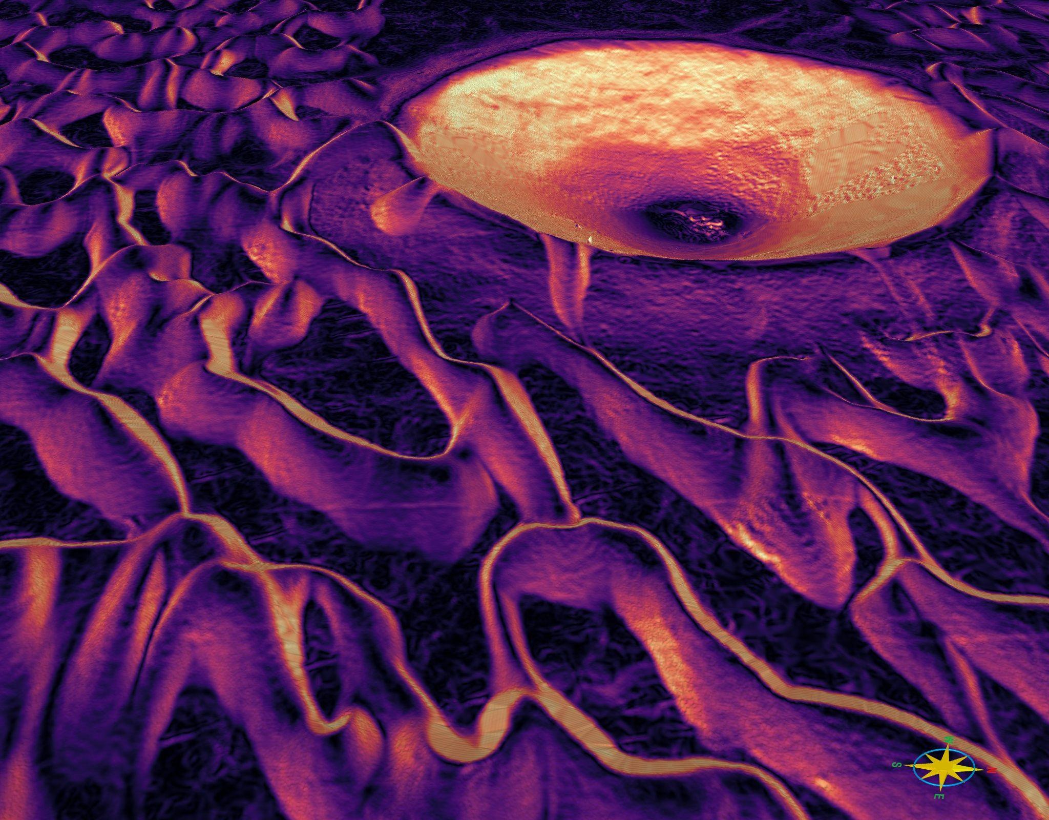
To demonstrate the potential of HiRISE data visualisation, we present a video showcasing the Meroe Patera Dune field, visualised using VRGS. With over 100 million triangles and no decimation, this model offers an immersive experience of the Martian landscape. Even with demanding data requirements, modern hardware such as an Alienware desktop with an RTX 3090 graphics card ensures smooth navigation and interpretation of this vast dataset.
Generating a dip attribute (as seen in the video) from the HiRISE data uncovers the intricate and fascinating geometry of the Martian dune field and reveals the true shape of the crater. By analysing the dip angle and orientation of the terrain, researchers can gain deeper insights into the formation processes and dynamics of the dunes. The dip attribute provides a visual representation of the variations in slope and inclination across the landscape, allowing for a comprehensive understanding of the interplay between wind patterns, sediment deposition, and erosion. Moreover, this attribute sheds light on the structural characteristics of the crater, unveiling its unique shape and providing clues about its geological history. The combination of elevation models derived from the high-resolution imagery from HiRISE and VRGS's interpretation and analysis tools opens up new avenues for studying the complex interactions between landforms and geological processes on the Martian surface.
Immerse yourself in the captivating world of HiRISE imagery and embark on an extraordinary journey to unlock the mysteries of Mars. The high-resolution images captured by HiRISE, combined with the advanced visualisation capabilities of VRGS, offer unprecedented opportunities for scientific exploration and visualisation of the Red Planet.