
Exploring St. Ninian's Cave: A Photogrammetric Adventure
Photogrammetry opens up exciting possibilities for geoscientists, offering a valuable tool for documenting, studying, and sharing the geology and heritage around us.
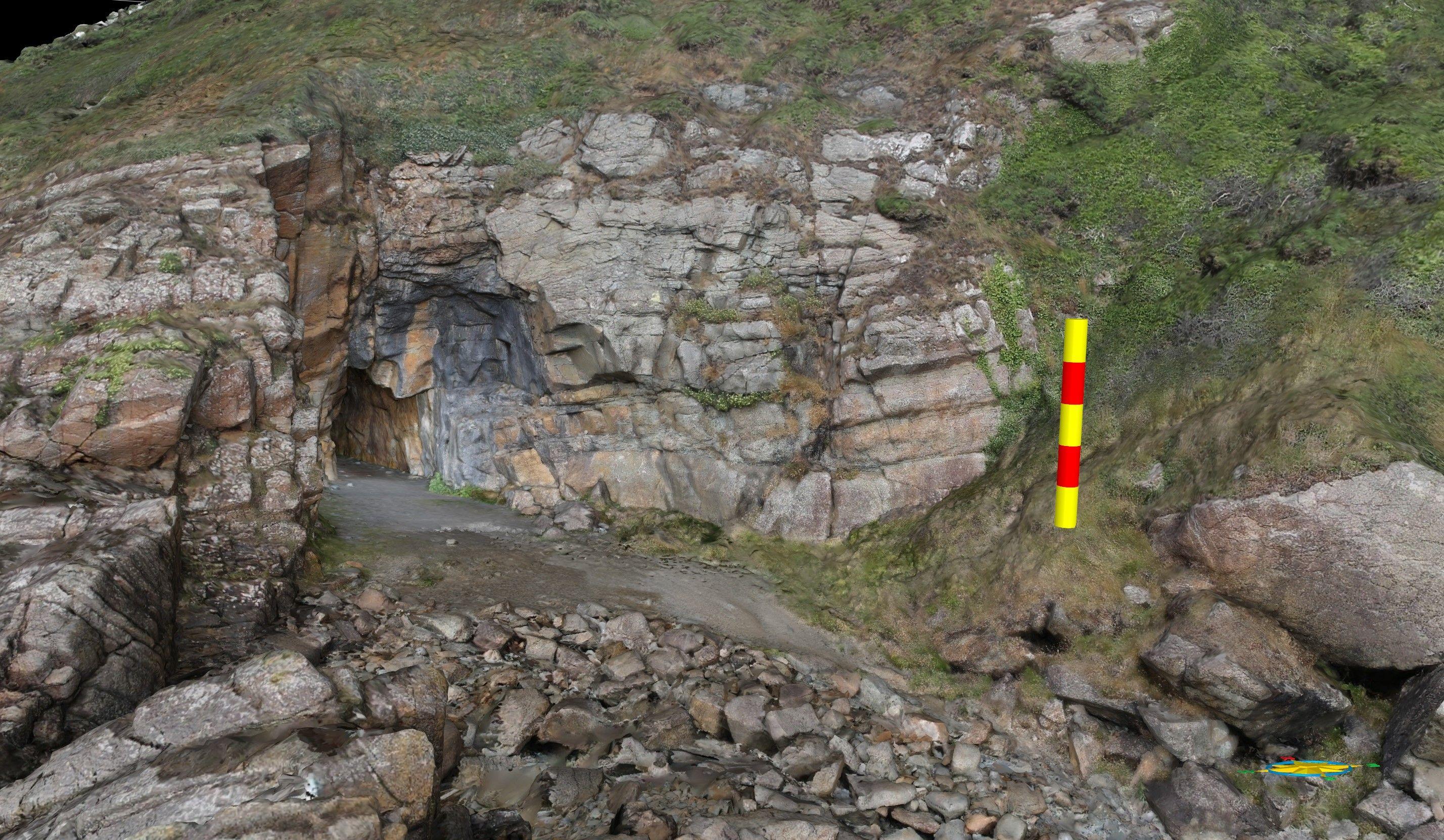
Photogrammetry, a powerful technique in the field of geoscience, allows researchers to reconstruct detailed 3D models using a series of photographs. In this blog post, we delve into the world of photogrammetric reconstruction as we explore St. Ninian's Cave, near Whithorn in Dumfries and Galloway, Scotland. Utilizing a digital SLR camera and basic equipment, we capture the essence of this historical and serene location, highlighting the potential for creating informative and immersive models even with limited resources.
**The Significance of St. Ninian's Cave **
St. Ninian's Cave holds immense historical and cultural importance. Tradition has it that it was here the early Christian Saint sought retreat and solitude. Nestled in the Silurian Carghidown Formation, this cave has been a pilgrimage site for centuries, attracting visitors seeking tranquillity and spiritual connection. Known as a place of worship and reflection, it provides a unique window into the past.
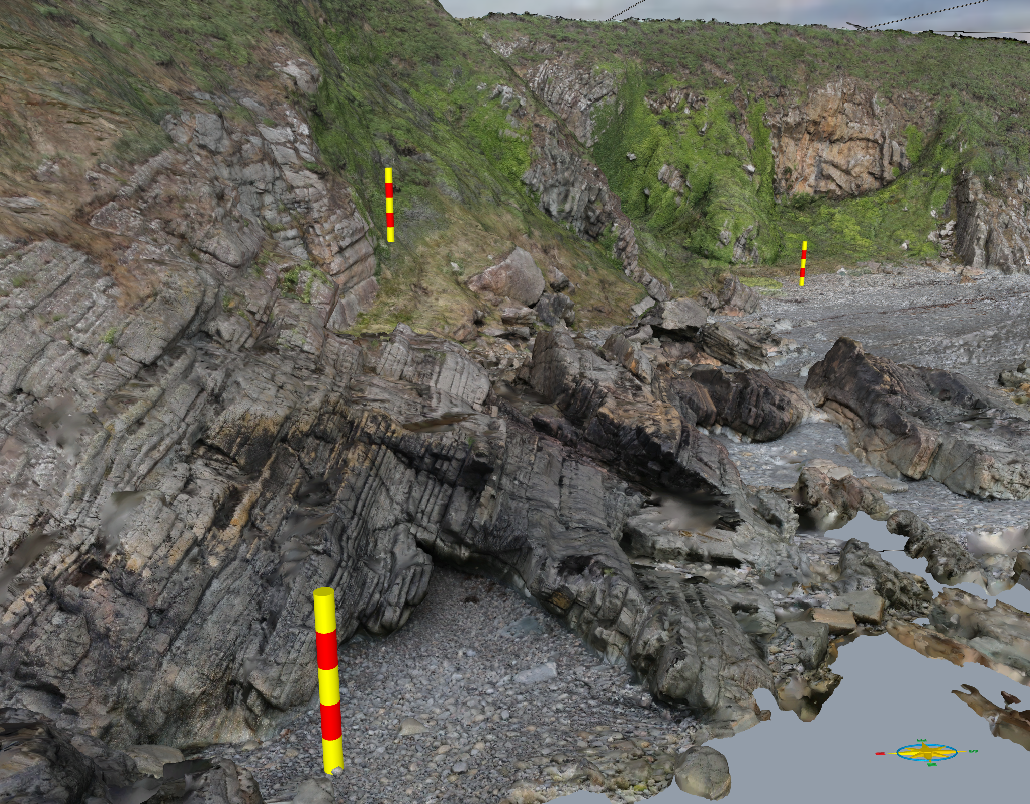
Photogrammetric Data Collection:
To capture the cave's intricate details, we used a digital SLR camera to capture approximately 400 images. These images serve as the foundation for reconstructing the 3D model. With a simple handheld GPS device and additional reference points from Google Earth, we georeferenced the images, ensuring accurate spatial information for the model.
The Power of Photogrammetric Reconstruction:
What makes photogrammetry truly remarkable is its ability to create highly useful and detailed models with relatively basic equipment and limited field time. Our photo timestamps revealed that the entire image collection process took around 1.5 hours, highlighting the efficiency of this approach. Despite the simplicity of the setup, the resulting model is a testament to the power of photogrammetric reconstruction.
Respecting the Tranquillity:
Although drone imagery could have potentially improved the model further, it was essential to preserve the tranquillity and historical significance of St. Ninian's Cave. The use of drones might disrupt the serene atmosphere and disturb visitors seeking solace in this sacred place. Hence, we opted for a quiet approach, ensuring minimal intrusion.
Exploring the Model:
The resulting model of St. Ninian's Cave is visualized in VRGS (Virtual Reality Geological Studio), our platform for navigating and interacting with 3D geological models. Using a game controller in this case, we can easily explore the virtual model. Scale bars within the model provide a sense of dimension, with each bar representing 5.0 meters.
Our photogrammetric reconstruction of St. Ninian's Cave has highlighted the potential of this technique for geoscientists and many others. With a simple camera and limited equipment, we were able to create a detailed and informative 3D model, capturing the essence of this historical site. By respecting the location's tranquillity, we ensured that future visitors can continue to enjoy the serenity and spiritual significance of St. Ninian's Cave. The cave is in fact currently closed to allow conservation work (St Ninian's Cave | Public Body for Scotland's Historic Environment accessed 23/5/23) so having a virtual model has added impact allowing an interactive virtual visit.
Photogrammetry opens up exciting possibilities for geoscientists, offering a valuable tool for documenting, studying, and sharing the geology, and heritage around us.