
VRGeoscience Limited Newsletter
It has been a remarkably busy 10 months since beginning the VRGeoscience Limited journey, and there have been many exciting developments to VRGS over that time.
Welcome to the first VRGeoscience Limited newsletter
Over the past 10 months there have been significant developments and improvements to VRGS. New updates are deployed on a regular basis, usually weekly though sometimes more often. The ability to rapidly deploy an update means I can quickly respond to a user’s request for a new feature or a bug-fix. From making an edit to the code to deploying to the release site can take as little as 30 minutes.
VRGS updates
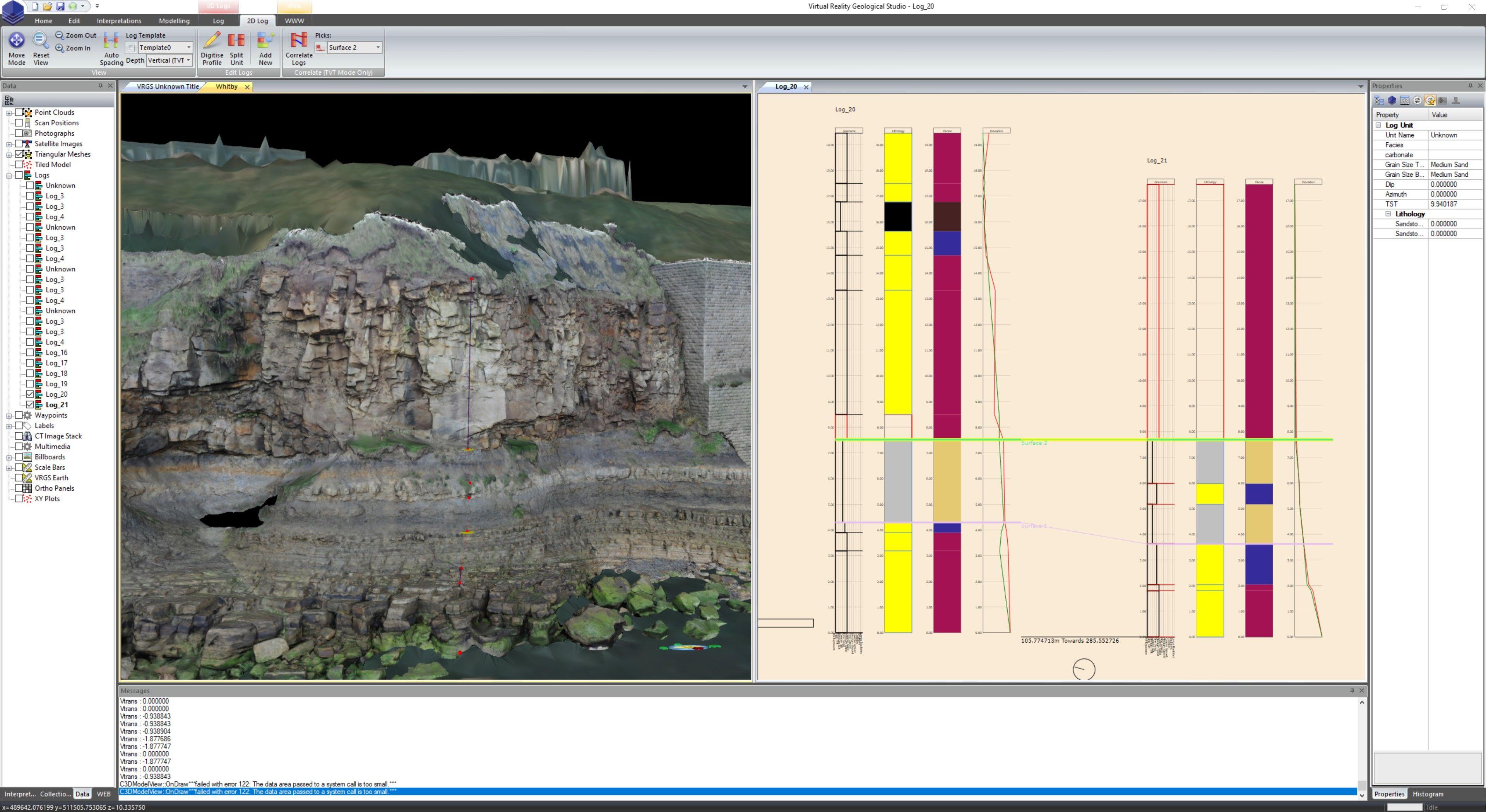
As of today, VRGS is at release 2.65 Build 7. This release sees the addition of user defined attributes to polylines giving the ability to store more data attached to the interpretations. This new feature will be propagated to all objects in later releases. Since spinning-out there have been many new features including:
- support for tiled models
- new interpretation and editing tools
- improvements to the user interface
- many performance improvements
- a new integrated web browser
Many of the updates have been driven by the ever-growing user base in both academia and industry, delivering the tools and features needed by users.
The licensing system has been updated to provide floating licenses. These are available to Professional and Enterprise users, providing a significant step in making the software license easier to share.
The New VRGeoscience.com Website
VRGeoscience.com had a major overhaul earlier in the year. The new website is based around the React and Gatsby frameworks, and gave me the chance to work on my JavaScript programming skills. It has significantly better performance than the previous site, as well as being much easier to maintain. This also lays the foundation for the upcoming GeoTour3D website.
Virtual Field Training and GeoTour3D
Interest in using VRGS for virtual field training has increased dramatically recently, with adoption in both academia and industry. As someone who spent many years running field classes I fully understand how digital outcrops can enhance the learning experience. One of the new features designed with training in mind is navigating a model from links in a webpage. This is particularly useful when navigating large models in training courses.
GeoTour3D is a new cloud-based development from VRGeoscience. With fieldtrips being affected by lockdown, digital outcrops have become more relevant to geoscientists than ever. The issue has now become how to share these digital outcrop models in an effective and easy to use manner. There are existing offerings which can do the job but they either lack the specific tooling to be able to deliver virtual field training or are poorly designed and implemented. GeoTour3D will provide a data sharing platform designed and developed by geoscientists for geoscientists with User Experience, User Interface and security at its heart. The system under development will also provide a REST API to make the data more accessible. Find out more about GeoTour3D at https://www.vrgeoscience.com/geotour3d
And Finally:
Keep in contact with VRGeoscience on LinkedIn or Twitter, and if you haven’t tried VRGS yet then register for a free 30 day trial at the VRGeoscience Website or get in contact to find out more.