Understanding Georeferencing in VRGS
Georeferencing is a process that involves associating spatial data with a specific location on the Earth's surface. In simpler terms, it's the method of assigning real-world coordinates to each point of a dataset. This process is crucial in the field of geology, where data often needs to be visualised and analysed in the context of its geographical location.

By David Hodgetts
Published On 2023-08-25
Understanding Georeferencing in VRGS


Introduction
The ability to accurately locate and align geological data in space is crucial. This process, known as georeferencing, is a fundamental aspect of geological studies, enabling scientists to integrate data from different sources, compare datasets, and conduct precise spatial analyses.
VRGS offers a comprehensive suite of tools and features that support georeferencing, allowing users to accurately position their geological models and data in a virtual environment. But what exactly is georeferencing, and why is it so important in geological studies? And how does VRGS facilitate this process?
In this blog post, we will delve into the concept of georeferencing, explore its importance in geological studies, and demonstrate how VRGS supports this crucial process. Whether you're a seasoned geoscientist or new to the field, this guide will provide a deeper understanding of georeferencing and its role in enhancing your geological studies.
What is Georeferencing?
Georeferencing is a process that involves associating spatial data with a specific location on the Earth's surface. In simpler terms, it's the method of assigning real-world coordinates to each data point within a dataset.
The types of data that can be georeferenced are diverse and include images, maps, samples and 3D models. For geological studies, this could mean assigning geographical coordinates to a 3D model of a geological outcrop, a digital map, a hand specimen, or an aerial image of a field area.
The georeferencing process involves two key elements: control points and transformation parameters. Control points are known locations on the Earth that can be accurately identified within the dataset to be georeferenced. Transformation parameters, on the other hand, are mathematical functions that convert the coordinates of data points within the dataset to corresponding coordinates on the Earth.
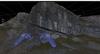
Whilst georeferencing and the methods involved are generally applicable, here we focus on georeferencing digital outcrop models using VRGS.
What are Ground Control Points and how do we get them?
Ground Control Points (GCPs) are specific points in the survey area that have been measured with a high degree of accuracy, often using a method such as differential GPS or a total station. These points are then identified in the photos and used to georeference the photogrammetry (or lidar) data.
Ideally, GCPs come from accurately surveyed positions, typically using Differential GPS (DGPS), but in many cases, this is not possible. There are several ways to obtain control points' real-world positions without using a Differential Global Positioning System (DGPS). Here are a few methods:
Existing Maps or Satellite Imagery
If the area of interest has been previously mapped or is visible in satellite imagery, these resources can be used to identify control points. For example, Google Earth provides global satellite and aerial imagery, and it allows users to obtain the latitude and longitude of any point on the Earth's surface. Though Google Earth does provide elevation information this is typically of low resolution and is the main limiting factor in using this approach to getting control point positions.
Landmarks and Known Geographic Features
Known geographic features such as road intersections, building corners, or distinctive landscape features that are easily identifiable can serve as control points. The coordinates of these features can often be obtained from existing maps or geographic databases.
Traditional Surveying Methods
Traditional land surveying techniques, such as triangulation or trilateration, can be used to determine the coordinates of control points. These methods can be time-consuming and may require specialised equipment and knowledge, but they can provide accurate results.
Publicly Available Geospatial Data
There are many sources of publicly available geospatial data that can provide control point information. For example, the Ordinance Survey provides a variety of digital mapping services that can be used to get georeferencing information, and similarly, the U.S. Geological Survey (USGS) provides a variety of geospatial data, including topographic maps, aerial photos, and satellite imagery.
Use of Georeferenced Images
Drones equipped with GPS and cameras can be used to capture images of the area of interest, with the camera location stored in the image data as it is acquired. These images can then be processed using photogrammetry software to create a georeferenced 3D model or map, with the camera positions acting as the control points. Some cameras also have built-in GPS or can connect to external GPS systems to georeference the images as they are taken. This often results in large numbers of GPS points (1 per image) for a photogrammetric dataset, and once the camera positions have been derived in the model the transformation can be calculated.
The choice between using ground control points (GCPs) or camera positions for georeferencing in photogrammetry depends on several factors, including the accuracy required for your project, the resources available, and the specific conditions of the area being surveyed.
Camera Positions or GCPs?
Camera Positions (Direct Georeferencing)
If your camera or drone is equipped with a high-quality GPS and IMU (Inertial Measurement Unit), it can record accurate position and orientation data for each photo at the time it's taken. This method, known as direct georeferencing, can be a quick and efficient way to georeference your photogrammetry data. However, the accuracy of the resulting 3D model or map will depend on the accuracy of the GPS and IMU data. If high precision is required for your project, the GPS and IMU data may not be accurate enough, especially in areas with poor GPS signals.


Drones typcally collect GPS data with the images which can be used for georeferencing purposes.
Ground Control Points (GCPs)
Using GCPs can provide a higher level of accuracy than direct georeferencing, especially in areas with poor GPS signals. However, it requires more time and resources, as the GCPs must be physically placed and measured in the field.
In many cases, a combination of both methods can provide the best results. Direct georeferencing can be used to provide a rough initial georeferencing, and then GCPs can be used to refine the accuracy. This approach can provide a good balance between efficiency and accuracy.
Ultimately, the choice between using GCPs or camera positions will depend on the specific requirements of your project. If high accuracy is crucial, GCPs may be the best choice. If efficiency is more important, and the accuracy of the GPS and IMU data is sufficient for your needs, direct georeferencing may be a good option. Remember, the accuracy of the georeferencing process depends on the accuracy of the control points. Therefore, it's important to use the most accurate methods available to obtain control point coordinates.
How many ground control points do you need?
The number of Ground Control Points (GCPs) needed to georeference a model can vary depending on the complexity of the model, the accuracy required, and the method of georeferencing used. However, as a general rule, a minimum of three GCPs are needed to perform a basic georeferencing operation. This allows for a simple affine transformation (translation, scaling, and rotation) of the model.
For more complex transformations that can account for distortions such as skew and non-uniform scaling, at least six GCPs are typically needed. This is often the case when georeferencing aerial or satellite imagery, where distortions can occur due to the perspective of the camera and the curvature of the Earth.
In practice, it's often a good idea to use more GCPs than the minimum required. This can help to improve the accuracy of the georeferencing operation, as it allows the software to calculate a more robust transformation that minimizes the overall error. More importantly, having extra GCPs can provide a means to assess the accuracy of the georeferencing operation by using some of the points as independent checkpoints.
It's also important to note that the GCPs should be well-distributed across the entire model. This helps to ensure that the transformation is accurate across the whole model, not just in the areas close to the GCPs.
How Georeferencing Works in VRGS
Georeferencing in VRGS is a straightforward process that allows users to accurately position their geological models in a virtual environment. Here's a step-by-step guide on how to perform georeferencing in VRGS:
Importing the Data
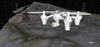
The first step in the georeferencing process is to import the geological data into VRGS. This could be LiDAR data, photogrammetry data, or any other type of spatial data that you want to georeference.
Identifying Control Points
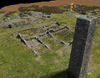
Next, you'll need to identify control points in your data. These are specific points in your data that can be accurately located in the real world. These control points could be features that are easily identifiable in the model and in the real world, such as the corner of a building, a distinctive rock formation, or Ground Control Points (GCPs) that were measured in the field during the data collection process.
Assigning Real-World Coordinates
Once you've identified your control points, the next step is to assign real-world coordinates to these points. This involves entering the X, Y and Z of each control point into VRGS. This information could come from a GPS device, a map, or any other source of accurate geographic information.
Performing the Georeferencing Operation
After the real-world coordinates have been assigned to the control points, VRGS can perform the georeferencing operation. This involves calculating a transformation that will align the geological data with the real-world coordinates. VRGS uses advanced algorithms to ensure that this transformation is as accurate as possible, minimising any errors or distortions in the georeferenced data.
Checking the Results
The final step in the georeferencing process is to check the results. This involves visually inspecting the georeferenced data in VRGS to ensure that it is correctly aligned with the real-world coordinates. If any errors or misalignments are detected (due to control points not being of sufficient accuracy), the georeferencing operation can be adjusted and repeated until the results are satisfactory.
Georeferencing outcrop models using the ICP approach
If you have some high-quality elevation data, such as the data from the UK's Environment Agency National LIDAR Programme, which provides 1 metre or better data for England you can use an iterative closest point approach to reduce the error in position between the outcrop model and the elevation data. This is a good way of ensuring your datasets match well, and reducing the error in the position of the model if the accuracy of your GCPs is low. A lot of countries now have national lidar programs and provide elevation data, or the OpenTopography site is always a great resource for additional elevation data.
Conclusion
Georeferencing is a powerful tool in the field of geology, enabling scientists to accurately position and align their data in a spatial context. By associating data with specific locations on the Earth's surface, georeferencing allows for a more accurate and comprehensive analysis of geological formations.
In VRGS, georeferencing is a straightforward process that involves identifying control points in your data, assigning real-world coordinates to these points, and then performing a transformation to align the data with these coordinates. Whether you're working with LiDAR data, photogrammetry data, or any other type of spatial data, VRGS provides the tools and features you need to perform accurate georeferencing.
Looking towards the future, as technology continues to evolve, we can expect georeferencing to become even more integrated and efficient. We encourage you to explore the georeferencing features in VRGS and see how they can enhance your geological studies.
Latest Articles