Why use digital outcrops?

By David Hodgetts
Published On 2022-04-29
Why use digital outcrops?


Having immersed myself in the field of digital outcrop modelling since 2000, I have witnessed its evolution from basic differential GPS mapping to the advanced techniques of lidar and Structure-from-Motion (SFM). Throughout this journey, I have always emphasised that a digital outcrop model (DOM) is an indispensable tool in a modern geologist's arsenal, complementing rather than replacing traditional fieldwork. When utilised correctly, a digital outcrop model can provide insights that go beyond what can be achieved through field observations alone.


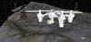
Drones have made digital outcrop data collection much easier
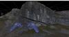
One of the significant advantages of a DOM is the ability to explore the outcrop from angles and viewpoints that are inaccessible in the physical world. By manipulating lighting conditions, employing attribute analysis, and making precise measurements from otherwise unreachable locations, geologists can gain a comprehensive understanding of the geological features. It opens up new avenues for analysis and interpretation, enhancing the geologist's ability to unravel complex geological puzzles.
In the early days of outcrop modelling, the equipment was cumbersome and required a team of three individuals to carry it. However, thanks to advancements such as structure from motion, we now have the luxury of collecting high-quality digital models using just a camera or a drone. The portability and accessibility of these technologies have significantly streamlined the data acquisition process, empowering geologists to create digital outcrop models with relative ease.
Fortunately, there are numerous tutorials available for creating these models, and both public domain and commercial software applications exist for the reconstruction phase. Armed with a camera and a keen eye, anyone can embark on the exciting journey of building their own digital outcrop model.
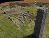
Of course, creating the model is just the beginning; the true value lies in the software used to interpret it. This is where VRGS (Virtual Reality Geological Studio) comes into play. Developed specifically to address the need for effective data interpretation, VRGS is an actively evolving software that has gained recognition across academia and industry worldwide.
In today's era of modern field geology, digital outcrop data has become an essential component of the geologist's workflow. If you haven't already embraced this technology, I encourage you to give it a try. The benefits it offers in terms of enhanced visualisation, analysis, and interpretation are invaluable in advancing our understanding of the geological world. Embrace the digital revolution and unlock new dimensions of geological exploration!
Claim your 30 day free trial of VRGS today and unlock a world of immersive geological exploration:
Latest Articles