Outcrop.io: A FAIR Data Platform for Digital Outcrop Models
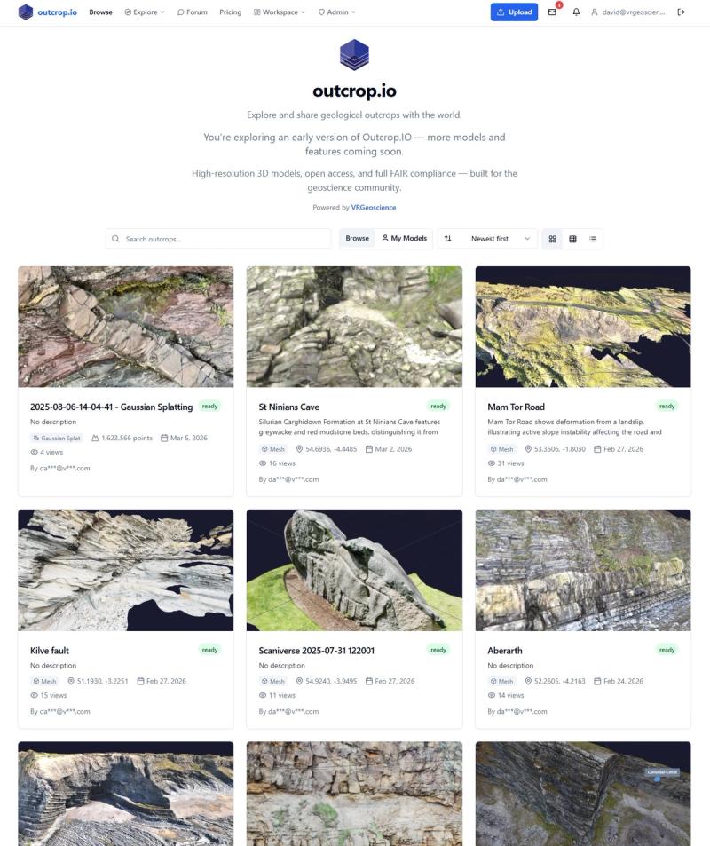
Outcrop.io is a cloud-native platform purpose-built for geoscientists to store, visualise, interpret, and share digital outcrop models. It is the infrastructure layer that the geosciences have been missing - designed from the ground up around the specific needs of 3D geological data.

By David Hodgetts
Published On 2026-03-06
Last Edited : 2026-03-06
Outcrop.io: A FAIR Data Platform for Digital Outcrop Models

The Problem: Geological Data Deserves Better
Every year, geoscientists around the world capture thousands of extraordinary 3D outcrop models. Drone photogrammetry, terrestrial LiDAR, handheld scanners - the acquisition technology has never been better. Gigabytes of scientifically valuable data are generated on every field campaign.
And then what happens?
The models end up on external hard drives. They get emailed as zip files. They sit in departmental shared folders that nobody can find two years later. Published papers reference 3D datasets that readers have no way of actually viewing. When a PhD student finishes and moves on, their data often moves on with them - or simply disappears.
This is the reality of digital outcrop data management in the geosciences today. We have world-class tools for capturing geological data, but almost nothing purpose-built for managing, sharing, and preserving it.
At VRGeoscience, we've lived this problem for years. Our team has spent countless hours in the field collecting digital outcrop models - and then struggled with the same ad-hoc workflows as everyone else when it came to organising, collaborating on, and publishing that data. We knew there had to be a better way.
So we built one.
What is Outcrop.io?
Outcrop.io is a cloud-native platform purpose-built for geoscientists to store, visualise, interpret, and share digital outcrop models. It is the infrastructure layer that the geosciences have been missing - designed from the ground up around the specific needs of 3D geological data.
At its core, outcrop.io provides:
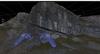
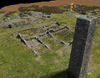
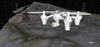
- Browser-based 3D visualisation - View point clouds, meshes, 3D Tiles, and Gaussian splats directly in the browser using Potree and Three.js. No software installation, no plugins, no licence fees. Measure distances, add labels, and toggle geological overlays - all from any device with a web browser.
- AI-powered search - Our search engine, Athos, understands natural language. Ask it "Jurassic carbonate outcrops in southern Europe" and it searches across metadata, descriptions, linked references, and spatial data to find relevant results. It goes far beyond simple keyword matching.
- Academic publishing tools - Every outcrop can be published with a DOI via Zenodo in a single click. Formatted citations are generated automatically in APA, BibTeX, Harvard, Chicago, and RIS. Link your ORCID profile to ensure proper attribution. Connect the academic papers that studied each outcrop, and explore citation graphs through OpenAlex.
- Collaboration workspaces - Create organisations for your research group or team. Share reference libraries. Use Git-style version control for geological interpretations - branch, annotate, compare, and merge. Request peer reviews with full status tracking and comment threads.
- A global exploration map - Every public outcrop is plotted on an interactive map with real-world coordinates. Switch between base layers, toggle geological overlays from Macrostrat, and use spatial search to find models near any location on Earth - or let the AI filter the map for you.
The platform supports a wide range of standard formats: LAS, LAZ, PLY, E57, XYZ, PTS, OBJ, glTF, GLB, SLPK, and Gaussian splats on ingest; GeoJSON, VRGS, BibTeX, and RIS on export.
Why FAIR Matters - and Why Geoscience is Behind
The FAIR principles - Findable, Accessible, Interoperable, Reusable - have become the gold standard for scientific data management. Disciplines like genomics, climate science, and astronomy have embraced FAIR wholeheartedly, building data infrastructure that makes research outputs discoverable, open, and reusable by default.
Field geology has lagged behind. The 3D nature of outcrop data, the diversity of file formats, and the lack of domain-specific repositories have all contributed to a situation where most digital outcrop models are effectively invisible to the wider scientific community once a project concludes.
Outcrop.io was designed around FAIR from day one. Here is how the platform addresses each principle:
Findable
Data that cannot be found cannot be reused. Outcrop.io makes digital outcrops findable through multiple complementary mechanisms:
- Persistent identifiers - One-click DOI minting via Zenodo gives every published outcrop a globally unique, permanent identifier that can be resolved independently of the platform.
- Rich, structured metadata - Location coordinates, coordinate reference system (EPSG), geological age range, formation, lithology, acquisition method, and acquisition date are all captured and indexed. A data quality score provides a completeness metric that encourages thorough metadata entry.
- AI-powered discovery - Athos indexes metadata, descriptions, tags, and linked references to support natural language queries that go beyond what traditional search can offer.
- Schema.org markup - JSON-LD structured data is embedded in every public outcrop page, making datasets discoverable via Google Dataset Search and other aggregators.
- Spatial discovery - The global map and proximity search allow exploration by geography, not just text.
Accessible
Findability means nothing if users cannot actually access the data once they locate it. Outcrop.io removes the barriers:
- No software required - The browser-based 3D viewer renders point clouds, meshes, and other formats without any download or installation. A colleague, reviewer, or student can view a model by clicking a link.
- No account required for public data - Public outcrops are openly viewable by anyone.
- Embeddable viewer - An iframe embed allows publications, lectures, and websites to include interactive 3D outcrop views inline.
- Programmatic access A REST API and MCP (Model Context Protocol) servers provide machine-readable access to outcrop data, enabling integration with scripts, pipelines, and AI tools.
- Mobile support - Progressive Web App (PWA) support means the platform works on phones and tablets, including direct upload from field scanning applications.
Interoperable
Geological data spans a dizzying array of formats and conventions. Outcrop.io is built to be a polyglot:
- Broad format support - The platform ingests all major point cloud and mesh formats and exports interpretations and references in standard, widely-supported formats.
- Standards-based metadata - EPSG coordinate reference systems, geological ages in Ma, and standard classification schemes ensure metadata is machine-readable and consistent with community conventions.
- Open integrations - Zenodo, ORCID, OpenAlex, Crossref, and Macrostrat are all connected through their standard APIs. Outcrop.io does not operate in isolation - it plugs into the existing scientific data ecosystem.
- MCP servers - The Model Context Protocol allows AI assistants and automated tools to query and interact with outcrop data directly, opening the door to new forms of computational geoscience.
Reusable
A 3D outcrop model without context is just a pretty point cloud. Reusability requires provenance, licensing, and documentation:
- Clear licensing - Every outcrop carries an explicit licence chosen from established options: CC0, CC-BY, CC-BY-SA, CC-BY-NC, ODbL, or PDDL. There is no ambiguity about what downstream users can do with the data.
- Version history - Git-style version control for geological interpretations means every change is tracked, comparable, and reversible. Branches allow parallel interpretation workflows.
- Citation support - Formatted citations in five standard styles make it trivial to properly credit data creators. DOIs ensure citations resolve permanently.
- Linked references -Connecting academic papers to the outcrops they study creates a provenance chain from field acquisition through to publication, giving future users the scientific context they need.
- Peer review - Interpretation branches can be formally reviewed, with status tracking (open, approved, changes requested, merged, closed) and threaded comments providing a full audit trail.
Who is VRGeoscience?
VRGeoscience is a geoscience technology company founded by geoscientists who understand the domain because we work in it. Our team has deep experience in digital outcrop modelling, geological interpretation, and research data management. We have spent years in the field collecting the kind of data that outcrop.io is built to manage - and we have experienced first-hand every frustration that comes with the absence of proper tooling.
Outcrop.io is the platform we wished existed when we started. We are building it not just as a product, but as infrastructure for the geoscience community - because we believe that digital outcrop data is a scientific output that deserves to be preserved, shared, and built upon, just like any publication.
Get Involved
Outcrop.io is live and we are actively looking for early adopters - researchers, field geologists, research groups, and teaching departments who work with digital outcrop data and want a better way to manage and share it.
- Explore public outcrops at outcrop.io
- Upload your models and see them rendered in 3D instantly
- Publish with a DOI and make your field data a permanent part of the scientific record
- Join the community forum to discuss techniques, share discoveries, and shape the platform's future
Whether you are capturing drone photogrammetry of coastal cliffs, scanning carbonate platforms with LiDAR, or teaching structural geology with 3D models in the classroom - outcrop.io was built for you.
Your outcrops deserve better than a folder on a hard drive.
Outcrop.io is developed by VRGeoscience. For enquiries, feedback, or partnership opportunities, get in touch through the platform or visit our website.
Latest Articles